Exploring London (Holly Kunst, Cyprus, ITP 2024)
Written by Holly Kunst, Collections Manager, The Centre of Visual Arts and Research (CVAR) (Cyprus, ITP 2024)
The last free day! What to do? So much London still to see. Squeeze in some more museums perhaps? Venture into neighbouring communities? These would have been very good ideas had I remembered that I was writing the blog for today. However, I did not. After more than a week of a bad cold I was looking forward to a bit of a sleep-in followed by plenty of nothing. Fortunately for you good readers I did eventually crawl out into the afternoon sun. I was on a mission, no less, to buy new sneakers, mine having been thoroughly inundated by London’s gentle summer rains.
I started my adventure on the Shoreditch High Street, working my way along the eclectic Brick Lane towards Whitechapel, enjoying lots of quirky shops and street food along the way. I’ll spare you the play by play and just say that I ended my search in Soho before heading back to Schafer house to put my feet up, which impressively survived the day of walking in a pair of old flip-flops.
Something I could not help noticing throughout the day, thanks to BM Curator Thomas Kiely who took us on a Greek revival walking tour on Thursday, was all the different architectural styles, facades, and strange layouts for road ways. I wish I could say that I was now looking up at buildings, and with great eruditeness, proclaiming this one to be Georgian and another to be quite obviously Regency, and do note the doric columns. To be fair I was doing exactly that inside my head with an accuracy level of about 0.8%, but I was noticing the differences now in a way that was more informed than before.
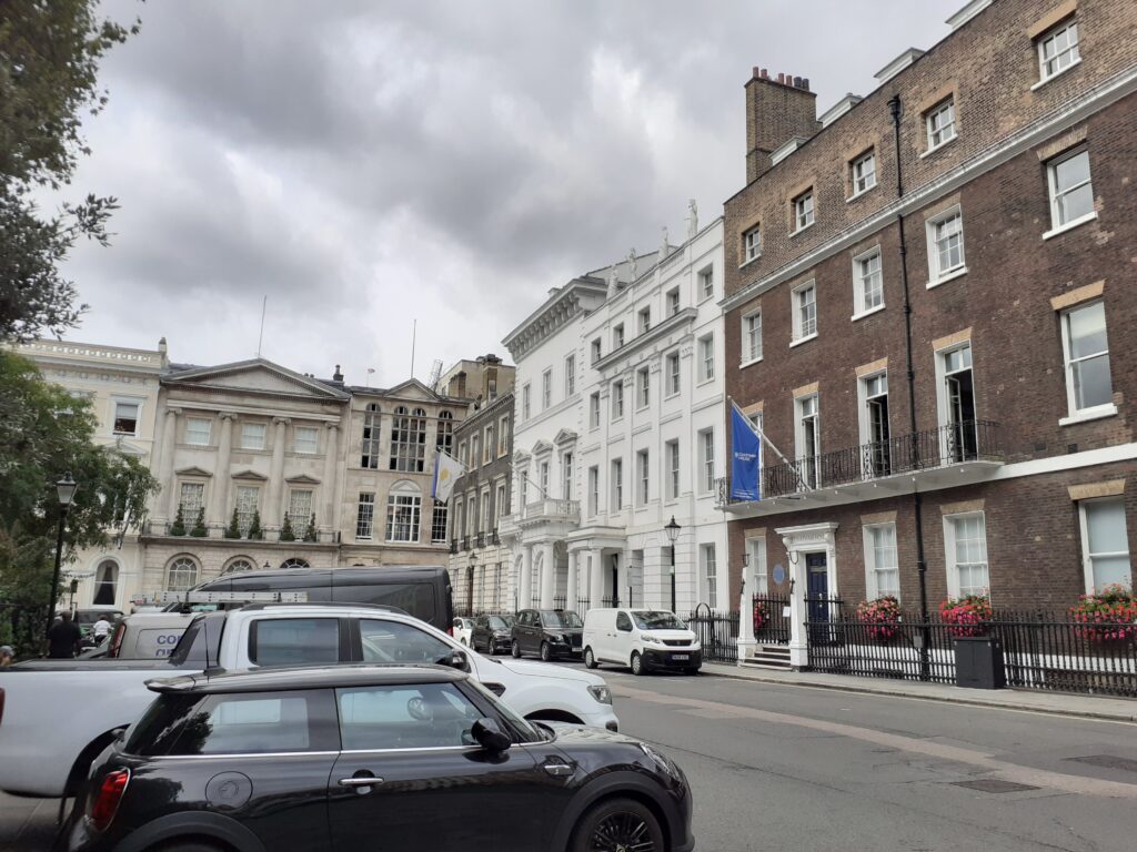
More than this I was noting all of the streets, going in all directions, which previously just looked like bad urban planning to me. But now, thanks to Thomas, they looked more like urban planning on top of later urban planning, on top of later urban planning. Just as styles for buildings come and go, the design of neighbourhoods went through their own aesthetic shifts which reflected both their function and relative affluence at the time. How often have we seen a tiny square with narrow streets coming off of it in all directions like a pinwheel, crosscutting (and being crosscut by) major throughways and thought to ourselves, what the heck were they thinking? Now, with the help of the visual aids brought along by Thomas, I can see how such spaces would have existed as stand-alone neighbourhoods, likely surrounded by fields, beautifully designed as a charming wealthy neighbourhood possibly with a statue at its centre. But as the city grew and needs changed these spaces were absorbed and altered until only bits and pieces remained, identifiable only to those in the know or in possession of various historic city maps.
Most interesting to me was how streets could be used to alter demographics. Neighbourhoods that were thought to be a hotbed of rebellious sentiment could be remedied by ploughing a nice wide road through the middle, displacing countless unsavoury residents (without their consent) and reducing their numbers in a particular area. This seems to have happened quite frequently right up until compensation for such disruption became more commonplace.
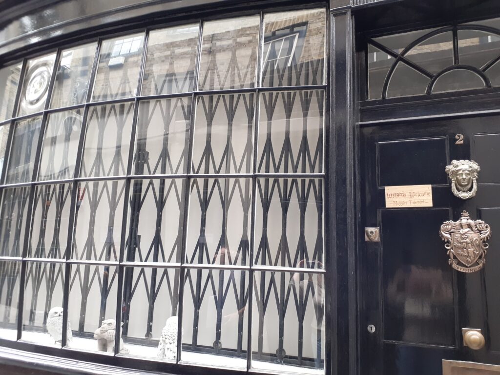
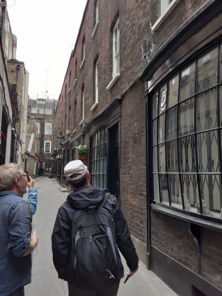
Finally, it was very interesting to note that all of the tiny alleyways of today may very well have been the main or only throughways a few centuries ago. Okay, maybe not all, but certainly some of them, including ones that today have been blocked at one end making them little more than a driveway to some rear parking behind a building. Hard to imagine, looking at them today, all of the carts and people bustling down these Hogsmeade-esque passageways.
So, there you have it. Even on my day off my mind is swimming with information as I look out at the city through new eyes.